Serengeti Migration Map & Route Logic
Understand the migration route by season — how rainfall, fresh grazing and the great rivers shape the clockwise loop through the Serengeti–Mara ecosystem — and use that logic to avoid booking the wrong region for your dates.

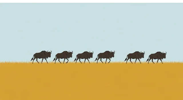
Photo: Hendrik Cornelissen / Unsplash
- ✓The migration traces a rough clockwise loop: south for calving, west through the Grumeti, north to the Mara crossings, then back south.
- ✓Three forces draw the route on the map — rainfall, fresh grazing and the permanent water of the northern rivers.
- ✓The two river barriers, the Grumeti in the west and the Mara in the north, are where the loop's drama concentrates.
- ✓Geography is fixed, but timing is not: the herds follow the rains, so verify the live picture for your exact dates.
- ✓Most wrong-region bookings come from picturing the loop as a single point rather than a moving centre of gravity.
Reading the loop as a map, not a calendar
It helps to picture the migration as a shape on the ground rather than a date on a page. The herds trace a rough clockwise circle through the Serengeti–Mara ecosystem: down on the southern Ndutu plains for calving in the green season, swinging west through the Western Corridor and the Grumeti River in early dry season, pushing north to the Mara River for the dry-season crossings, then curling back south as the short rains break. The circle is remarkably consistent in its geography year after year — what shifts is the timing of each leg.
Once you see the route as a loop driven by landscape, the planning logic becomes obvious. You are not chasing a moving dot; you are choosing where on a fixed circuit you want to stand, and then timing your visit to when the herd's centre of gravity is usually there. The map below orients the sectors and rivers that anchor the loop.
The full story of how the year-round loop works.
Park areas & sectorsHow each sector on the loop differs in landscape and season.
Map pins
Map data © OpenStreetMap contributors · Tiles © OpenFreeMap
The three forces that draw the route
Three things, working together, decide where the line on the map goes. Understand them and you can reason about the migration rather than memorise dates.
First, rainfall. The herds chase the rain because rain greens the grass. The wet season starts in the south and east, which is why the loop bottoms out there in the green months, and the dry season strips the south bare, which is why the herds are forced north toward permanent water. The whole circuit is, at heart, a year-long pursuit of falling rain.
Second, grazing quality. Not all grass is equal. The southern short-grass plains, fertilised by volcanic ash blown off the Ngorongoro highlands, are exceptionally nutritious — ideal for grazing and for raising young, which is why the herds calve there. As that grazing is exhausted, the herd moves to the next flush of green, and the route follows the freshest pasture around the circle.
Third, the rivers. The Grumeti in the west and the Mara in the north are the loop's great barriers and its great theatres. In the dry season they hold the only reliable water, so the herds are funnelled to their banks — and the crossings, with their waiting crocodiles, are the consequence. The rivers are why the northern and western legs of the route are fixed where they are.
- Rainfall: the herds chase the rain, which greens the grass.
- Grazing: volcanic-soil short grass in the south is prime calving pasture.
- Rivers: the Grumeti and Mara are the dry-season water — and the crossing points.
The route, leg by leg
Walk the circle once and the map makes sense. Each leg is a stretch of the loop tied to a sector and a rough season — averages, not appointments.
South (green season) — the Ndutu and southern plains. The herds spread across the short grass to calve, with predators close behind. This is the bottom of the loop, anchored by the best grazing in the ecosystem.
West (early dry season) — the Western Corridor and the Grumeti River. As the south dries, the columns swing west and meet their first river barrier, where smaller, scattered crossings unfold among the river's crocodile-haunted pools.
North (dry season) — Kogatende and the Mara River. The leading herds push to the far north and the Mara, where the signature crossings happen, often shuttling back and forth across the Kenyan border in pursuit of grazing.
Return south (short rains) — through Lobo and the central plains. As the short rains break, fresh grass reappears in the south and east, and the herds stream back down to close the loop and begin again.
How to avoid booking the wrong region
Almost every disappointing migration safari comes down to one error: treating the herd as a single point and booking a beautiful camp that happens to be on the wrong leg of the loop for the travel dates. A lodge that is perfectly placed for the August crossings can be a half-day's drive from the action in February, and no amount of luxury closes that gap. The map is the cure. Decide your chapter, find its leg on the loop, and book a camp on that leg for that season.
Two refinements protect you further. Remember that the herd is enormous and strung out, so 'where the migration is' is a centre of gravity, not a pin — its front and tail can sit in different sectors in the same week, which is why proximity and flexibility beat chasing a single coordinate. And remember that timing slides with the rains: verify the live picture for your exact dates before you pay a deposit, and again before you travel. Ask any operator specifically which sector you will be based in, and how long the daily game drives to the herds will be — vague promises of 'seeing the migration' are how wrong-region bookings happen.
- Match your camp to the leg of the loop for your season, not to the prettiest photo.
- Treat the herd as a moving centre of gravity; favour proximity and flexibility.
- Verify the live position for your dates before booking and before travelling.
- Ask which sector you will be in and how far the daily drives are — get specifics.
Reading the rivers and gateways on the map
The features that turn the migration map from a vague oval into a useful planning tool are the rivers, because they are where the loop's drama concentrates and where camp placement matters most. Three watercourses shape the route. The Grumeti River runs through the Western Corridor and presents the migration's first major water obstacle, usually around May and June, with its own resident crocodiles staging smaller, less predictable crossings than the famous northern ones. The Mara River, in the far north around the Kogatende and Lamai sectors, is the stage for the headline crossings of the dry season, where the herds mass and pour across in the scenes that define the migration in most people's imaginations. The smaller seasonal rivers and the Ndutu lakes in the south anchor the calving grounds early in the year, where water and short green grass draw the herds to give birth.
Knowing where these features sit on the map lets you read the whole route as a logical journey rather than a random wander. The herds spend the early year on the southern Ndutu plains, drift west and north-west toward the Grumeti as those plains dry, face the Grumeti around mid-year, push on into the far north to gather at the Mara through the dry season, and then loop back south as the short rains green the southern plains again. Each river is therefore tied to a season and a sector, which is exactly the information you need to place a camp: a Grumeti-season trip belongs in the west, a crossing trip belongs in the north near the Mara, a calving trip belongs in the south near Ndutu. Read the rivers, and the rest of the map falls into place.
The practical lesson is to use the map's rivers and sectors as your booking checklist. Identify which water feature your chosen chapter revolves around, confirm that the camp you are considering sits within easy game-drive reach of that feature for your exact dates, and remember that proximity to the right river in the right season is worth more than any other quality a camp can offer. As always, these are long-term patterns rather than a fixed schedule, and the herds move with the rains, so verify the live position before you commit. Let the rivers organise the map, place your camp by the feature your chapter needs, and you will have done the single most important thing to get a migration safari right.
- The Grumeti (west, about May–June) is the migration's first major water obstacle, with smaller crossings.
- The Mara (far north, dry season) hosts the headline crossings most people picture.
- The Ndutu lakes and southern streams anchor the calving grounds early in the year.
- Each river ties to a season and sector — west for Grumeti, north for the Mara, south for calving.
- Place your camp within game-drive reach of the right river for your chapter, and verify the live position.
Related guides

The Great Migration in the Serengeti
How the Great Migration actually works — the year-round clockwise loop through the Serengeti–Mara ecosystem, why the rains run the show, where the herds usually move month to month, and how to plan a safari around it without pretending nature is on a timetable.
Read guide
Serengeti Areas & Sectors Guide
A guide to the Serengeti's sectors — central Seronera, the southern Ndutu plains, the Western Corridor and Grumeti, the far north at Kogatende, plus Lobo and the Moru Kopjes — and how to choose the right one for your season and style.
Read guide
The Great Migration, Month by Month
Where the wildebeest herds usually are in the Serengeti for each month of the year — calving in the south, the Grumeti in the west, the Mara crossings in the north — with the realistic odds of a river crossing and the right sector and camp to aim for.
Read guideMore in When to Go
6
Best Months for Serengeti Photography
Which Serengeti months deliver the photographs you want — dramatic light and dust, emerald plains, newborns, river crossings, big cats and fewer vehicles in your frame.
Read guide
Calving Season in the Serengeti
Calving season on the southern Serengeti plains around Ndutu — when roughly half a million wildebeest are born in about three weeks, why it draws the densest predator action of the year, and how to plan a green-season safari around it.
Read guide
Calving Season in the Serengeti (Ndutu)
Calving season on the southern Serengeti plains around Ndutu — when roughly half a million wildebeest are born in about three weeks, why it draws the densest predator action of the year, and how to plan a green-season safari around it.
Read guide
Calving Season vs River Crossings
Two faces of the Great Migration: the southern Ndutu calving in the green months, and the northern Mara crossings in the dry. Decide between them by wildlife, budget, crowds, predictability and the kind of drama you want.
Read guide
Christmas & New Year in the Serengeti
How to plan a Christmas or New Year safari in the Serengeti — green December plains, gathering herds, premium festive camps, family-friendly logistics and the flights that make a holiday trip work. Romantic, festive and worth booking early.
Read guide
Great Migration Planning Mistakes
The planning mistakes that make travellers miss the herds, overspend, or book the wrong Serengeti sector — and how to avoid each one so your dates, your camp and the migration actually line up.
Read guide