Serengeti Map & Regions: How to Read the Park
A map-led guide to the Serengeti's regions — the central Seronera core, southern Ndutu plains, Western Corridor, far-north Kogatende and the Lobo corridor — with gates, airstrips, rivers and how to plan a trip around the migration.

- ✓The Serengeti is vast — roughly 14,750 km² — and splits into distinct regions, each effectively its own country of grass.
- ✓The core sectors are central Seronera, the southern Ndutu plains, the Western Corridor (Grumeti), the far-north Kogatende (Mara), and the Lobo corridor between.
- ✓Gates (Naabi Hill in the south-east, Ndabaka in the west, Ikoma in the west, Klein's in the north-east) and airstrips (Seronera, Kogatende, Ndutu, Grumeti) define how you reach each region.
- ✓Rivers organise the map: the Seronera and Orangi in the centre, the Grumeti and Mbalageti in the west, the Mara in the north.
- ✓Because the herds move, the right region for your trip is set largely by your month — read the map together with the migration calendar.
Why the map matters more than the name
It is tempting to think of the Serengeti as a single place — one plain, one experience, booked under one name. The reality is that the park is enormous, roughly 14,750 square kilometres, and it behaves less like a destination than like a small country with very different regions. A camp in the far north and a camp in the south can be the better part of a day's drive apart, in completely different landscapes, with completely different wildlife on offer in a given month. Choosing where to stay without reading the map is the single most common way travellers end up hours from the action they flew across the world to see.
This guide is the map-led overview: how the park divides into regions, where the gates and airstrips sit, how the rivers organise the land, and — crucially — how to read all of that alongside the migration calendar so that your region matches your month. Use it as the orientation layer beneath the more detailed sector guides, and as the first decision you make about a Serengeti trip, before camps, before style, before anything else.
Map pins
Map data © OpenStreetMap contributors · Tiles © OpenFreeMap
The five regions of the Serengeti
The clearest way to hold the Serengeti in your head is as five regions, each with its own character, season and reason to visit. Central Seronera is the beating heart of the park: a valley of rivers, riverine fig trees and granite kopjes holding the densest resident population of lions and leopards, reliable in every month regardless of where the herds are. It is where most first safaris are based and where many trips begin.
The southern Ndutu plains spill onto the Ngorongoro Conservation Area edge — open, treeless, volcanic-soil grassland that becomes the great calving ground when the herds gather there in the green season. The Western Corridor stretches toward Lake Victoria along the Grumeti and Mbalageti rivers, narrow riverine forest threading through it, and hosts the migration's first river crossing as the herds move through. The far north around Kogatende holds the Mara River and the famous crossings — the most remote region and, in the dry season, the crossing country everyone pictures. And between the centre and the far north lies the quiet Lobo corridor, north-central country that the herds pass through in transition and that rewards travellers wanting fewer vehicles.
- Central Seronera: rivers, kopjes, year-round resident big cats — the reliable core and most common base.
- Southern Ndutu plains: open short-grass calving country on the Ngorongoro edge, best in the green season.
- Western Corridor (Grumeti): riverine forest toward Lake Victoria; the migration's first river crossing.
- Far-north Kogatende (Mara): the remote crossing country, at its best in the dry season.
- Lobo corridor: quiet north-central transition country with fewer vehicles.
Gates and how you enter
The Serengeti is too large for a single entry point, and the gate you use both reflects and shapes your route. Coming overland from Arusha and the Ngorongoro highlands — the classic Northern Circuit approach — you enter the south-east through the Naabi Hill gate, the main gateway onto the southern plains and the road to Seronera. It is the busiest gate and the natural choice for a drive-in safari combining the Crater and the central park.
From the west, the Ndabaka gate near Lake Victoria opens onto the far end of the Western Corridor, while the Ikoma gate near Robanda gives access to the corridor and the western edge, with its budget-friendly community-area stays. In the north-east, Klein's gate connects toward the Loliondo and Lobo country. Which gate you use is mostly a function of where you are coming from and which region you are heading for — and, increasingly, of whether you drive or fly, since fly-in travellers bypass the gates entirely and land at a bush airstrip.
- Naabi Hill (south-east): the main gate from Arusha and Ngorongoro onto the southern plains and Seronera.
- Ndabaka (west): the Lake Victoria end of the Western Corridor.
- Ikoma (west): the western edge near Robanda — gateway to the corridor and budget community-area stays.
- Klein's (north-east): toward the Lobo and Loliondo country.
Airstrips and how you fly
For fly-in travellers, the map is read in airstrips rather than gates. Light aircraft from Arusha and Kilimanjaro — and even Zanzibar — connect to a handful of bush airstrips spread across the park, each serving a region. The Seronera airstrip in the centre is the busiest, putting you in the heart of resident-cat country. The Kogatende airstrip in the far north is the key to the Mara crossings, turning a long overland slog into a short hop and buying precious days at the river. Ndutu's airstrip serves the southern calving plains, and Grumeti and other western strips serve the corridor.
Flying changes the whole shape of a trip: it bypasses the gates and the long road hours, makes the remote north practical on a shorter itinerary, and lets you string regions together by air rather than by drive. The trade-offs are cost and the strict baggage rules of small planes — soft duffels only, with firm weight limits. The practical rule is to match the airstrip to the region your month points to: fly into Kogatende for an August crossing trip, into Ndutu for green-season calving, into Seronera for a centrally based first safari.
- Seronera (central): the busiest strip, in the heart of resident big-cat country.
- Kogatende (far north): the key to the Mara River crossings in the dry season.
- Ndutu (south): serves the southern calving plains in the green season.
- Grumeti and other western strips: serve the Western Corridor.
Rivers: the lines that organise the map
If the regions are the chapters of the Serengeti, the rivers are the sentences that connect them. Water organises this landscape: it concentrates wildlife, shapes the migration's route, and gives each region its defining feature. In the centre, the Seronera and Orangi rivers thread through the core, their fig-lined banks famous for leopards and their pools — like the one at Retima — crowded with hippos. These permanent waters are much of why Seronera holds resident game all year.
In the west, the Grumeti and Mbalageti rivers run through the corridor toward Lake Victoria, narrow ribbons of forest in the grassland and the site of the migration's first river crossing. And in the far north, the Mara River is the great obstacle — the brown, crocodile-haunted water the herds must gamble across, and the stage for the crossings that define the northern season. Reading the rivers tells you where the wildlife concentrates, where the crossings happen, and why each region behaves the way it does.
Reading the map with the migration calendar
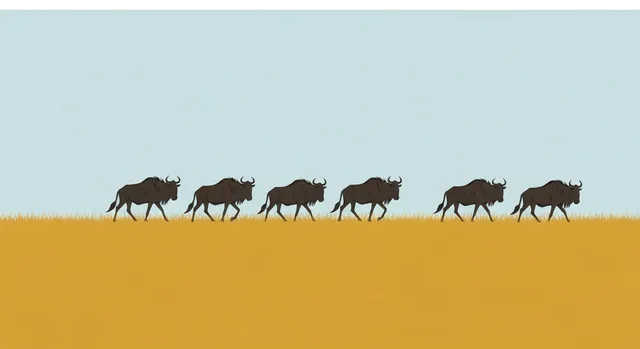
The map only makes sense alongside the calendar, because the herds move and the 'best' region changes through the year. Lay the migration over the regions and a clear logic emerges: the green season gathers the herds on the southern Ndutu plains for calving; as the plains dry, they push west through the Grumeti corridor for the first crossing; the dry season pulls them north to the Mara around Kogatende for the famous crossings; and the short rains turn them back south through the Lobo corridor toward the start of the loop. Central Seronera sits in the middle of all of it, holding resident game whatever the herds are doing.
Treat every one of those timings as a 30-year average rather than a promise — the migration follows rain, not a calendar, and a two-week swing in either direction is entirely normal. Always verify the likely position of the herds for your exact dates close to travel before you commit to a region and a camp. A lodge perfectly placed for an August crossing can be hours from the action in February, and vice versa.
The takeaway for planning is simple: choose your region first, driven by your month and the event you most want to witness, then choose your gate or airstrip to reach it, then choose your camp within it. Get that order right — map, then calendar, then bed — and you will spend your days where the Serengeti is at its best for the time you have come.
Common questions about the Serengeti's regions
How big is the Serengeti? Roughly 14,750 square kilometres — large enough that its regions are effectively separate destinations, sometimes the better part of a day's drive apart.
What are the main regions? Central Seronera (the resident-cat core), the southern Ndutu plains (calving), the Western Corridor along the Grumeti (the first crossing), the far-north Kogatende on the Mara (the famous crossings), and the quiet Lobo corridor between centre and north.
Which gate should I use? It depends on where you come from and which region you want: Naabi Hill in the south-east from Arusha and Ngorongoro, Ndabaka and Ikoma in the west, and Klein's in the north-east. Fly-in travellers bypass the gates and use bush airstrips.
How do I choose the right region? Choose by your month and the event you most want — calving, the first crossing, the Mara crossings, or year-round resident game — then pick the gate or airstrip to reach it. Read the map and the migration calendar together, and verify timing for your exact dates.
Can one trip cover several regions? Yes, with enough time. A week lets you combine, say, central Seronera with the far north, or the south with the centre — usually by flying between airstrips rather than driving the long distances. Shorter trips are better focused on a single region.
Related guides

Serengeti Areas & Sectors Guide
A guide to the Serengeti's sectors — central Seronera, the southern Ndutu plains, the Western Corridor and Grumeti, the far north at Kogatende, plus Lobo and the Moru Kopjes — and how to choose the right one for your season and style.
Read guide
Serengeti Airstrips Guide
A guide to the Serengeti's bush airstrips — Seronera, Kogatende, Grumeti, Ndutu, Lamai, Lobo and the rest — sector by sector, with which camps they serve and the seasons they matter most. How fly-in safaris really use them, and how to pick the right one.
Read guide
Where to Stay in the Serengeti
Where to stay in the Serengeti — how to choose the right sector, lodge or camp by your month, your migration goal, your budget, whether you fly or drive, and the wildlife you most want to see. Camp placement matters as much as comfort, so match the bed to the herd.
Read guideMore in Park Areas
6
Best Serengeti Area for a First Safari
A first-timer's decision guide to the Serengeti's sectors — central Seronera, the southern plains, the Western Corridor and the far north — chosen by month, budget and what you most want to see, with the honest trade-offs.
Read guide
Eastern Serengeti Guide
A guide to the eastern Serengeti — the wide-open, kopje-dotted plains east of Seronera, why they are some of the best cheetah country in the park, the low vehicle density that defines them, and when the eastern side is worth it.
Read guide
Grumeti: The Western Serengeti's River Country
A guide to Grumeti — the river, the wildlife and the exclusive private concessions on the Serengeti's western edge. Migration timing in the western ecosystem, giant crocodiles, and the luxury camps that draw travellers to this quiet corner.
Read guide
Ikoma & Fort Ikoma: Edge-of-Park Value in the Western Serengeti
A guide to the Ikoma area and Fort Ikoma on the western edge of the Serengeti — gateway to the Western Corridor, with drive-in access, budget-friendly stays in the Ikoma Wildlife Management Area, night-drive options and honest caveats.
Read guide
Moru Kopjes Guide
A guide to the Moru Kopjes in the central-southern Serengeti — the dramatic granite outcrops famous for lions and rock art, one of the park's last rhino strongholds, and how Moru fits a central-southern game drive.
Read guide
Namiri Plains Guide
A guide to Namiri Plains in the eastern Serengeti — the open, kopje-dotted cheetah country east of Seronera, why it is one of Africa's great predator landscapes, how camps are positioned, and who should go east.
Read guide